The landscape of modern infrastructure projects has drastically evolved with the introduction of advanced technologies. Two pivotal innovations—drones and 3D mapping—have revolutionized how infrastructure projects are planned, executed, and monitored. These technologies offer unprecedented levels of precision, cost efficiency, and real-time data collection. The integration of drones and 3D mapping into infrastructure projects is not only making construction faster and more efficient but also ensuring safer and more sustainable designs.
The Role of Drones in Infrastructure Projects
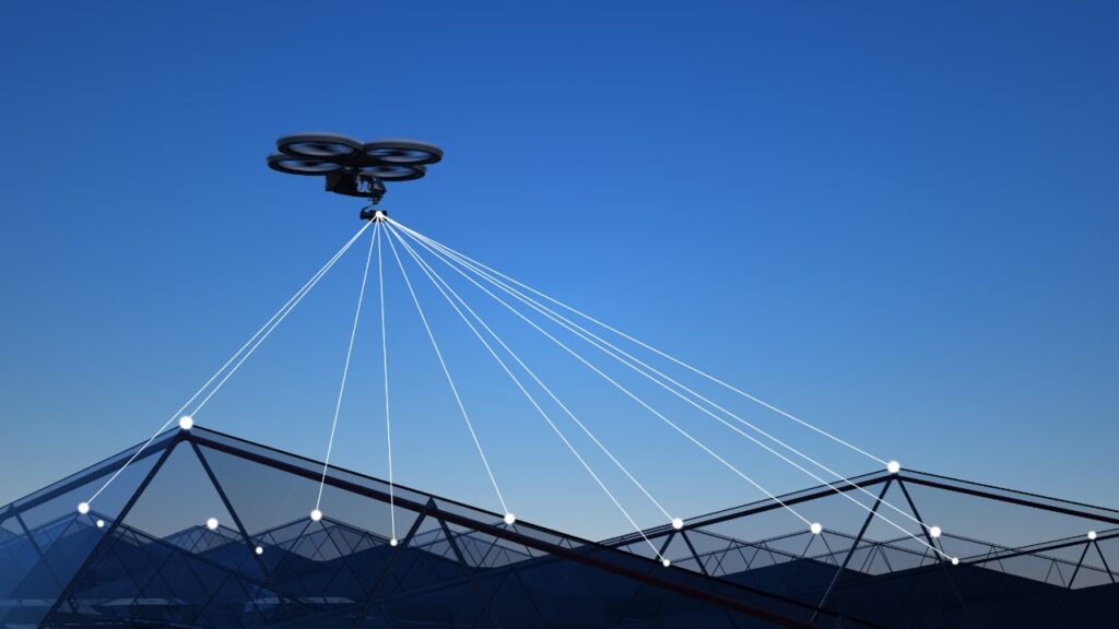
Aerial Surveys and Mapping
Drones are now a vital tool for conducting aerial surveys in infrastructure projects. They provide high-resolution aerial images and videos, crucial for large-scale construction projects. Drones can reach hard-to-access locations, delivering real-time data and reducing the need for traditional surveying methods.
Example: The Second Avenue Subway Project in New York used drones to monitor the construction site and track the progress of underground works. Drones provided a faster, more accurate alternative to traditional methods of surveying, saving both time and money.
Data: According to DroneDeploy, the global leader in drone software, drones can reduce the cost of aerial surveying by up to 80%, while providing data accuracy within 2-3 cm.
Site Inspections and Safety
Drones play an essential role in real-time inspection and safety monitoring, helping to identify potential hazards and ensuring the quality of infrastructure during construction.
Example: In China, drones are extensively used to inspect the Yangshan Deep Water Port. This aerial approach minimizes disruption to daily operations while offering comprehensive surveillance of the site’s infrastructure.
Data: The Federal Aviation Administration (FAA) estimates that the commercial drone market for infrastructure inspections will reach $3.8 billion by 2024, showcasing the growing reliance on drones for inspecting and monitoring infrastructure projects.
3D Mapping in Modern Infrastructure Projects
Improved Design and Visualization
3D mapping technology has transformed infrastructure planning by providing highly accurate, detailed visualizations. It allows for precise models of existing sites and future developments, helping engineers and architects in design and planning.
Example: The London Crossrail Project extensively used 3D mapping to create an underground model of the city’s railway system, which significantly minimized errors and delays during construction.
Data: According to Bentley Systems, 3D mapping improves design accuracy by up to 30% and reduces construction errors by approximately 15%.
Enhanced Efficiency in Planning
3D models provide infrastructure professionals with a much clearer understanding of the terrain, reducing the time spent on planning and offering greater precision in designs.
Example: In Florida, Kiewit used 3D mapping for the I-4 Ultimate Project, where a 3D model of the highway corridor was used to facilitate collaborative design and streamline the construction process.
Data: According to GIM International, 3D mapping technology has the potential to reduce design and planning time by up to 50%, making it a critical tool for large-scale projects.
Maintenance and Future Proofing
One of the key benefits of 3D mapping is its ability to aid in the long-term maintenance and monitoring of infrastructure. By digitally mapping the project, future inspections become more streamlined, and potential issues can be detected early.
Example: In Singapore, 3D city models are used in the Smart Nation Initiative to manage urban infrastructure. These models help with future-proofing by providing accurate data for urban planning and maintenance.
Data: Studies show that the use of 3D models can improve long-term maintenance by 60% by providing a detailed view of the infrastructure, making it easier to spot potential problems and plan repairs ahead of time.
The Combined Power of Drones and 3D Mapping in Infrastructure Projects
Real-Time Monitoring and Data Integration
When combined, drones and 3D mapping provide a comprehensive solution for monitoring construction progress. Drones capture real-time aerial data, which is then processed into detailed 3D maps, offering insights that help to keep the project on schedule and within budget.
Example: The Big Dig Project in Boston used drones and 3D mapping to inspect underground infrastructure, ensuring that the planning phase was accurately implemented and avoided costly rework.
Data: Projects that integrate drones and 3D mapping can cut down on unexpected delays by up to 40%, helping ensure that construction is completed on time and within budget.
Improving Collaboration
These technologies also enhance collaboration between various teams involved in infrastructure projects. With 3D mapping, all stakeholders—engineers, contractors, and architects—can visualize the same data, improving decision-making and reducing misunderstandings.
Example: In Dubai, the Museum of the Future project used drones and 3D mapping technologies to facilitate real-time updates for all teams involved. The combination allowed project managers to track progress, adjust timelines, and ensure efficient resource allocation.
Data: According to Autodesk, projects using both drones and 3D mapping see an average 15-20% increase in project collaboration, which leads to faster decision-making and fewer errors.
Conclusion
Incorporating drones and 3D mapping into infrastructure projects has become the new standard for efficient, cost-effective construction and maintenance. These technologies provide real-time data, improve accuracy, and enhance collaboration, allowing for smarter infrastructure development worldwide. By leveraging these advancements, construction companies can ensure that their projects are executed with greater precision, on time, and within budget—transforming the future of infrastructure.